
drone services.
LiDar/ photo scanning
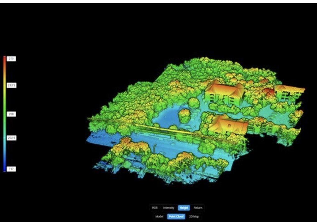
Quickly capture ultra-precise 3D models of your oilfield sites. Our drone-based LiDAR system maps tanks, pipelines, and facilities with centimeter accuracy — ideal for as-built documentation, site planning, and design coordination. The data integrates smoothly with AutoCAD and other engineering tools to keep your field and design teams aligned.

TDLAS Scanning
Detect methane and hydrocarbon leaks with high precision. Our drone-mounted TDLAS sensors scan pipelines, tanks, and valves — spotting leaks that traditional tools can miss. It’s faster, safer, and covers more ground than handheld methods. Each scan includes a heat map report for easy action and compliance tracking.

How Our Drone Services Save You Money
Reduce labor costs by replacing on-foot surveys and camera inspections with automated drone flights
Spot critical design issues like misgraded pads or tank layout bottlenecks early
Minimize rework delays and avoid downtime with clear, up-front data
Up to 70% savings on layout prep for piping, grading, or facility construction
What You’ll Receive
AutoCAD-ready DXF/DWG or LAS/LAZ files
2D methane heat maps and plume overlays
High-res elevation models and topographic maps
Google Earth KMZ overlays
Facility blueprint exports for design integration